
Lairig Ghru Race 2026 by Kenny Fairfield
I’ve been a member of the Harriers for a wee while now, and I am familiar – as we all are – with the regular conversation starter we all seem to have with one another which begins with “what are you training for” or “what’s next” in terms of our running / racing. Having completed my first trail marathon down in Grizedale earlier this year I found this question raised it’s head again – with the Lairig Ghru Race providing the answer.
I have spent many days in the Cairngorm Mountains over the years, however the last time I had set foot on the route of the famous Lairig Ghru was as a 16 year old Scout, completing part of a Duke of Edinburgh equivalent award. Albeit the route on that occasion (nearer to 40 years ago) was to hike with full kit from Aviemore to Braemar staying out in the hills for three days, I felt this immediately qualified me to run the opposite direction in the space of a few hours, and dispensed with the need to conduct any form of recce!!! I was fortunate though to have many fellow Harriers (and previous Lairig Ghru legends) on hand to provide what was to be invaluable advice ahead of the race.
The race, organised by Deeside Runners has become increasing popular since it’s inception in the 70’s so both myself and Nils signed up early on opening day and secured our places. The 350 online places quickly sold out, with race day seeing 240 at the start line, 236 recorded as finishing.
The weather in the couple of weeks leading up to race day (Sunday 28th June, 2026) saw temperatures soar even by our standards north of the border which made me re-think my strategy in terms of fuelling. Runners have to be self sufficient during the race as there are no water or aid stations over the 27 mile route. There is also a mandatory kit list (well it is a Hill Race) which I can confirm was policed strictly at registration! The official party line is that water is readily available at numerous burns along the route and water bottles can be refilled at “your own discretion” or more like hope there’s nothing nasty further upstream!. I made the decision to carry the 3 litres I guessed I would need, a decision I did not regret on the day.
We travelled from home up to Braemar on race day courtesy of Kathryn (and Bramble) with Nils and I registering early (just before 08:30) and before the three bus-loads arrived from Aviemore. The quiet village centre was thereafter transformed by a swarm of hill-running types all trying to find an available loo! Gordon then appeared to take part in a bit of spectating and some running in the Rothiemurchus area. Both he and Kathryn said the drive from Braemar to Aviemore on the largely single track road was a fantastic experience – thankfully both also narrowly avoided the traffic cop with the speed gun!
Some rain had been forecast for the morning, with a light shower or two coming in prior to the 10 o’clock kick off. That was to quickly blow though, with excellent conditions remaining for the rest of the day. After a short briefing we were off on time.
The route takes you west out of Braemar along the open public road (it’s very quiet) for around four miles tracing the route of the River Dee before crossing the Victoria Bridge and onto the private road leading to Mar Lodge. Running through this neatly kept estate onto another short tarmac road section, sees the route onto trail and upwards towards Derry Lodge. All very runnable, it would be quite easy to perhaps overcommit at this early stage in the day. I settled into a relaxed pace (for me) however also keeping in mind that there is a 90 min cut off at Derry Lodge (approx 8 miles in) with anyone later than this not allowed to continue.


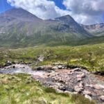

The route isn’t marked and after the check-point at Derry Lodge you can either ford the first river to your left, or go straight on a little bit further (the popular choice) and use the bridge to cross keeping your feet dry. Both of these options join back up a bit further west along Glen Luibeg. There the track begins to narrow as you head towards the crossing of Luibeg Burn. You can either plough through or pick your way over the rocks. The water level was low so I almost kept my feet dry at this point. There is a bridge further north up the burn, but this puts around 800m on the route.
After the Luibeg, I found the climbing started as you head towards the Lairig itself. The track narrows and can be awkward at points but provides an opportunity to run more often than not. The scenery from the start is stunning, however from here it becomes spectacular and there is a real balance to be struck between trying to enjoy the surroundings and not face-planting! You really do have to watch your foot placement.
The track continues up towards the boulder field and the Pools of Dee, where the Mountain Rescue base themselves for the duration of the race, checking race numbers as you pass. It’s easy to lose the “track” as you pick your way through the boulder field but keep to the higher right hand side from the start and it becomes clear. The boulder field is exactly what it says on the tin. There are boulders so pick your way through and you’ll be able to run again soon enough.
This is the highest point in the race at 835m. Its all downhill from here! There is a point here at around 17 miles where you can see Aviemore in the far distance. You have 10 miles to go from this point.
The path continues to be narrow, rocky and slightly awkward at times, but mostly runnable. The concentration required to ensure I didn’t fall over was a great distraction to the fact my legs were starting to feel it.
In terms of water and fuelling, I had been aware of several runners along the way having to stop and fill bottles and soft flasks from burns that at times looked pretty dry. As much as you never want to see anyone else struggling, I can’t deny that my decision to lug around 3kg of fluids gave me a fairly smug feeling that I didn’t have to deal with this level of admin whilst on the move. I for one find filling a soft flask from a tap can be a challenge, and getting one back into a running vest, wet and in a hurry is not fun!
From here you continue downhill and into the ancient Caledonian Forest at Rothiemurchus. The rocks give way to tree roots as the number one trip hazard, so keep looking ahead (and down) all the time. The change of scenery was welcome, albeit the shelter from the wind made it feel noticeably warmer. Around six miles out the route had really levelled and the trail was easy going underfoot. With little to distract me from the fact my legs were now pretty tired, I really found this the hardest part of the day.
For the last couple of miles it’s flat all the way along the side of the main road between Coylumbridge to the finish line on Dalfaber Road in Aviemore. I crossed the line in 5:25:42, with Nils having finished in 5:10:50. As you may expect there’s no frills at the finish line. No medal, no real snacks to speak of, no fuss but an immense feeling of pride.
The big question is – would I do it again? Absolutely! I think both Nils and I would love it if a squad of Harriers decided to take part next year. I may have already been on the phone to someone today planting that seed…..!